
Your site,
explained.
Weekly drone flights. AI-analyzed. Delivered in 24 hours.
Three things in your
inbox every week.
A branded PDF report your team can forward as-is. A curated set of full-resolution aerial photos. And a live, interactive site map your owner, lender, and GC can open from any device — no login, no install.
- Zoomable orthomosaic — sub-3cm per pixel
- Side-by-side comparison of any two flights
- Findings pinned at exact ground location
- Elevation & earthworks tracking
- Distance, area & volume measurement
- Site plan overlay
- 3D site model
- Shareable view-only link — no login required
Flight to inbox in 24 hours.
CJ, our Part 107 certified pilot, conducts a systematic aerial survey of your entire project site. Same pilot every flight. He knows your site.
Imagery is stitched into high-resolution orthomosaic maps and run through AI analysis — detecting installed work, flagging changes, and tracking progress by trade and zone.
AI reads the processed data and pilot observations to write a plain-English executive summary. Flagged issues, progress since last flight, anything your PM needs to act on.
A branded Corvus report lands in your inbox within 24 hours. Forward it to your owner or investor as-is.
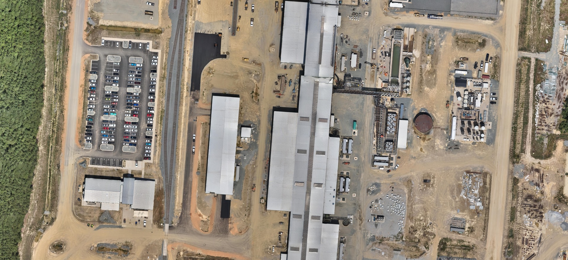
One flight caught a faulty concrete pour
the contractor had reported 85% complete.
The drone showed otherwise.
Nucor avoided $600,000 in rework costs.
forced full remediation
monitored at Nucor
monitoring
on every flight